
The Border Track: Corner Post to the Coast
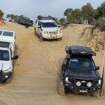
The Border Track defines the state border between South Australia and Victoria. It runs from MacCabe Corner on the Murray River to the Southern Ocean between Piccaninnie Ponds, SA and Nelson, Vic. We took 8 days to do the return trip from Wagga Wagga, with a lay-day at Renmark and a detour to the Pink Lakes area but some long days driving on the track itself. When I do it again I’d spend more time on the track with shorter days – there’s plenty to see!
Unfortunately once again there’d been plenty of rain before and during the early part of the week and some of the bog holes (which we were expecting) on the southern part of the track were impassable, or at least not worth the risk to vehicles and within our time constraints. On the other hand the rain and coolish weather made the sand (Lots. Of. Sand.) driving easy and fun!
- Distance
- 949.40 km
- Elevation gain
- +2,557 m
- Elevation loss
- −2,572 m
- Max elevation
- 170 m
- Waypoints
- 26
Watch my video summary of the trip on Relive here:
You can also download the GPX file containing the track and a bunch of useful waypoints here:
Download The Border Track GPX file